AI-Powered Digital Mapping

See what changed. Plan what comes next.

Updated maps, insights and reports, delivered on your schedule. PLANETRA uses AI to turn Earth imagery into detailed vector maps for the places you manage.

Scroll to zoom in

Land outlines: Natural Earth 1:50m. Malaysia highlighted in mint.

What the name means

PLANETRA brings together planet and netra, the word for eye. We act as an eye on the planet, helping people see, understand and interpret the places that matter to them.

Purpose
Help people understand a changing world through useful, accessible geospatial information.
Where we start
Malaysian-rooted, with an identity built to be read anywhere.

How it works

From Earth imagery to informed decisions

  1. 01

    Digitize

    Convert Earth imagery into structured vector maps: building footprints, parcel boundaries, waterways and land-use regions.

  2. 02

    Discover

    Compare mapped features between surveys to identify the patterns and changes that need attention.

  3. 03

    Decide

    Receive insights and automated reports that support informed action, at intervals agreed with you.

Maps are the foundation. Understanding and decisions are the outcome.

Outputs

What the work looks like

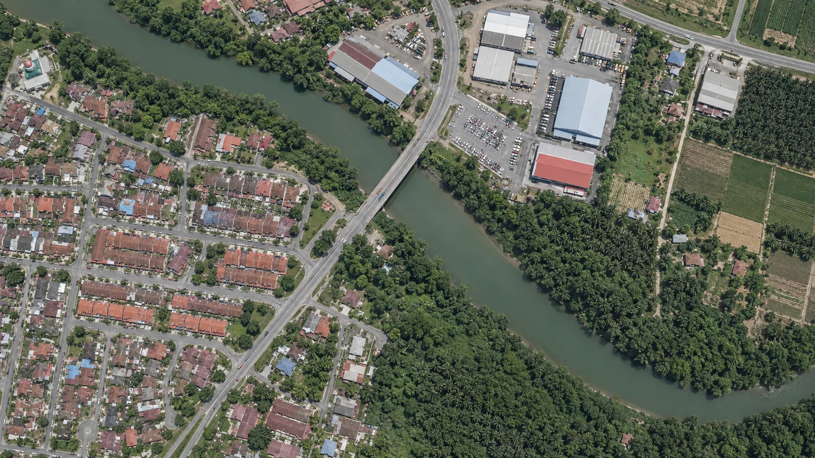
One river town, four views. Imagery goes in, and structured maps, detected features and a layered 3D view come out.

These are concept renders for illustration. They are not results from a real analysis.

Keep scrolling

01 / 04

Input

Earth imagery

Aerial or satellite imagery of the area you manage is the starting point. Survey dates and coverage are recorded from the first step.

02 / 04

Digitize

Land-use and parcel vectors

Imagery becomes structured regions: parcels, waterways, forest, farmland and built-up areas, each a layer you can measure and query.

03 / 04

Discover

Feature detection

Buildings, trees and vehicles are identified and outlined as polygons, so they can be counted and compared between surveys.

  • Buildings, outlined footprints
  • Trees, canopy outlines
  • Vehicles, rounded boxes

04 / 04

Decide

Spatial layers in 3D

Footprints and heights combine into a 3D view of the area. Highlighted buildings show where attention is needed next.

Imagery to vector map

See the imagery behind every mapped feature.

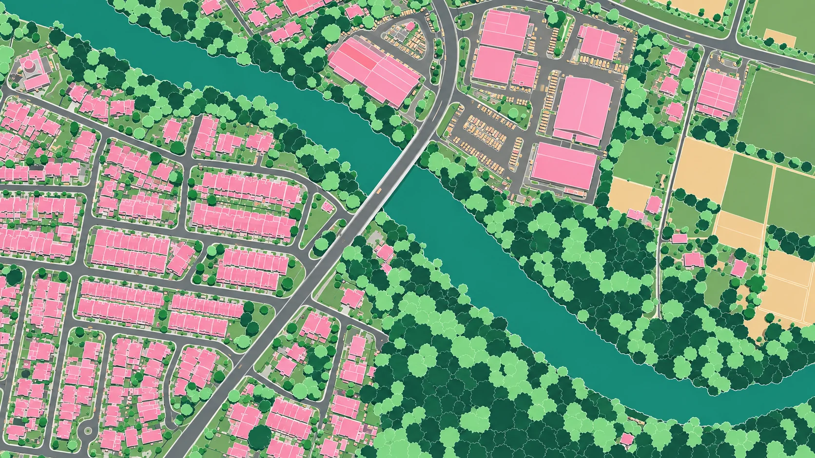
The map shows the vector output, with buildings, tree canopy, water, farmland and roads each as their own class. Move your cursor across it to reveal the original aerial imagery underneath.

Vector map classified output

Aerial-to-vector conversion

Lens aerial imagery

Concept vector map of a riverside town: buildings in pink, tree canopy in greens, the river in teal, farmland in peach and roads in grey
  • Buildings
  • Tree canopy
  • Water
  • Farmland
  • Roads

Concept images for illustration, not a real analysis result. This view shows aerial-to-vector conversion. Change detection compares vector maps from two survey dates.

Who we serve

Built for the people who manage places.

Our work has to hold up in a government briefing and be useful to a geospatial specialist. Each output leads with practical value and keeps the technical detail close at hand.

Government agencies

What you need

Clear information, dependable delivery and outputs you can explain and use.

  • Dated maps and reports with documented methods
  • A consistent record across surveys
  • Findings written for briefings

Credibility · clarity · accountability
City planners

What you need

Current spatial understanding and visibility into the changes that affect your plans.

  • Up-to-date footprints and land-use regions
  • Change highlighted by area and category
  • Updates matched to your planning cycle

Practical insight · relevance · confidence

Geospatial specialists

What you need

Precise, understandable mapping outputs and transparent methods.

  • Structured vector layers
  • Notes on methods, coverage and limitations
  • Outputs that fit your GIS workflow

Technical competence · precision · usefulness

Platform preview

One workspace, from survey to report.

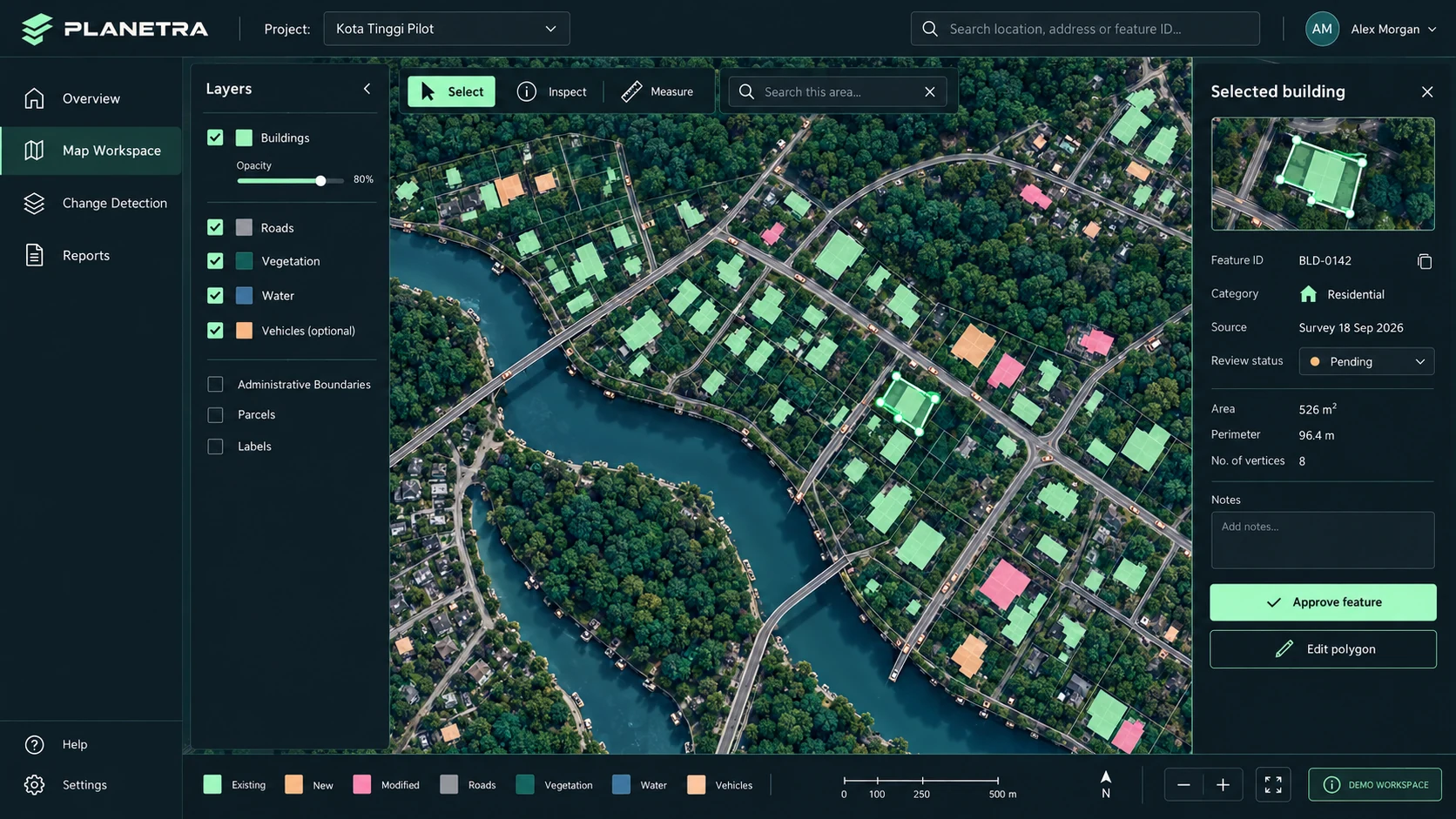
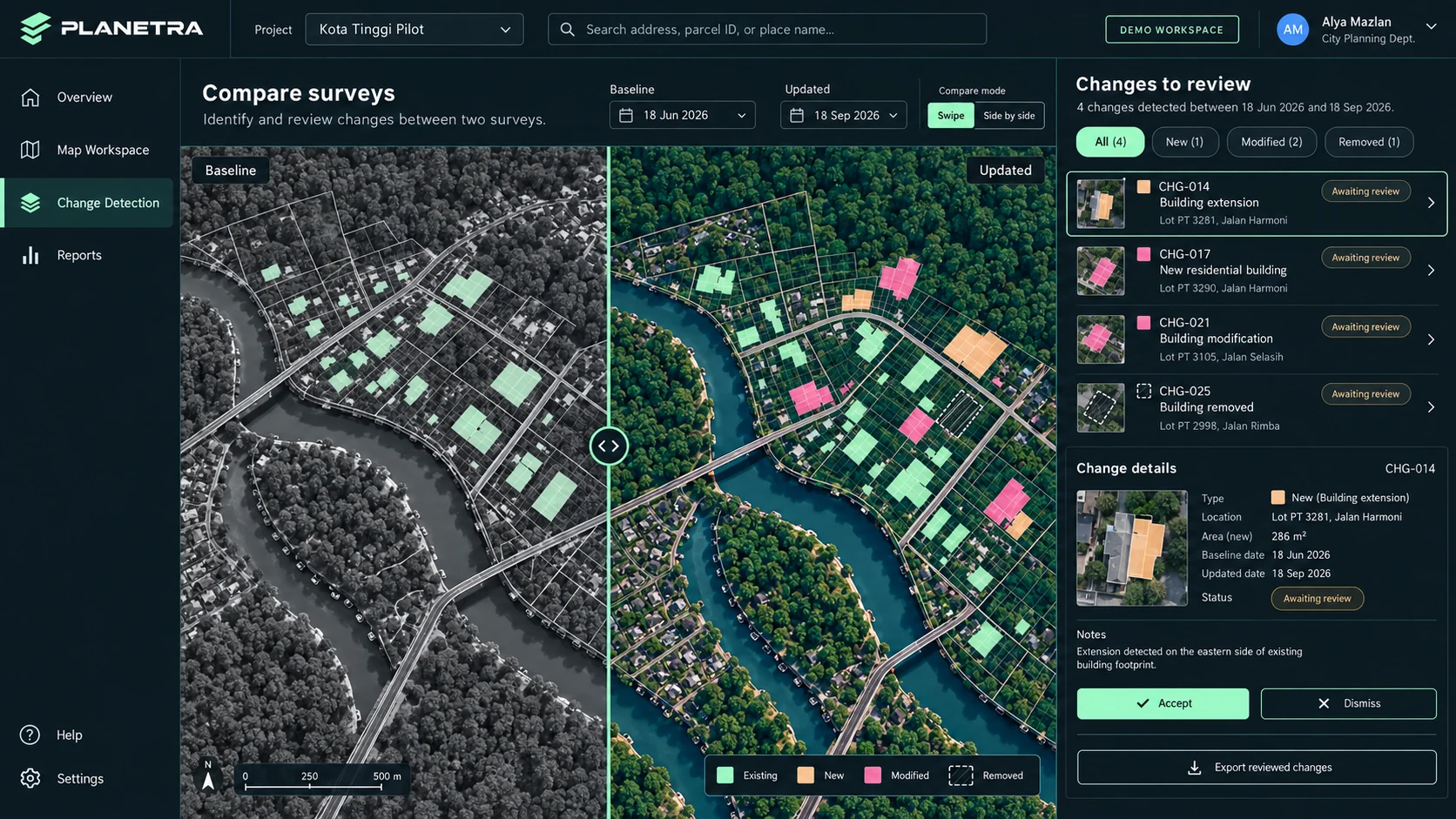
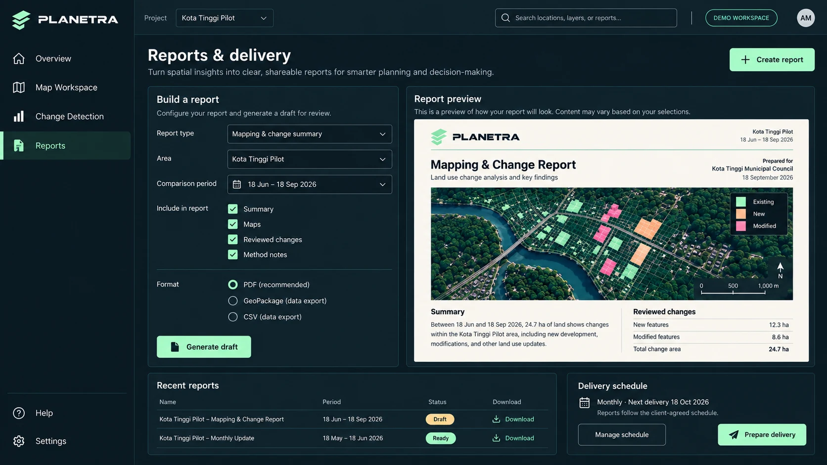
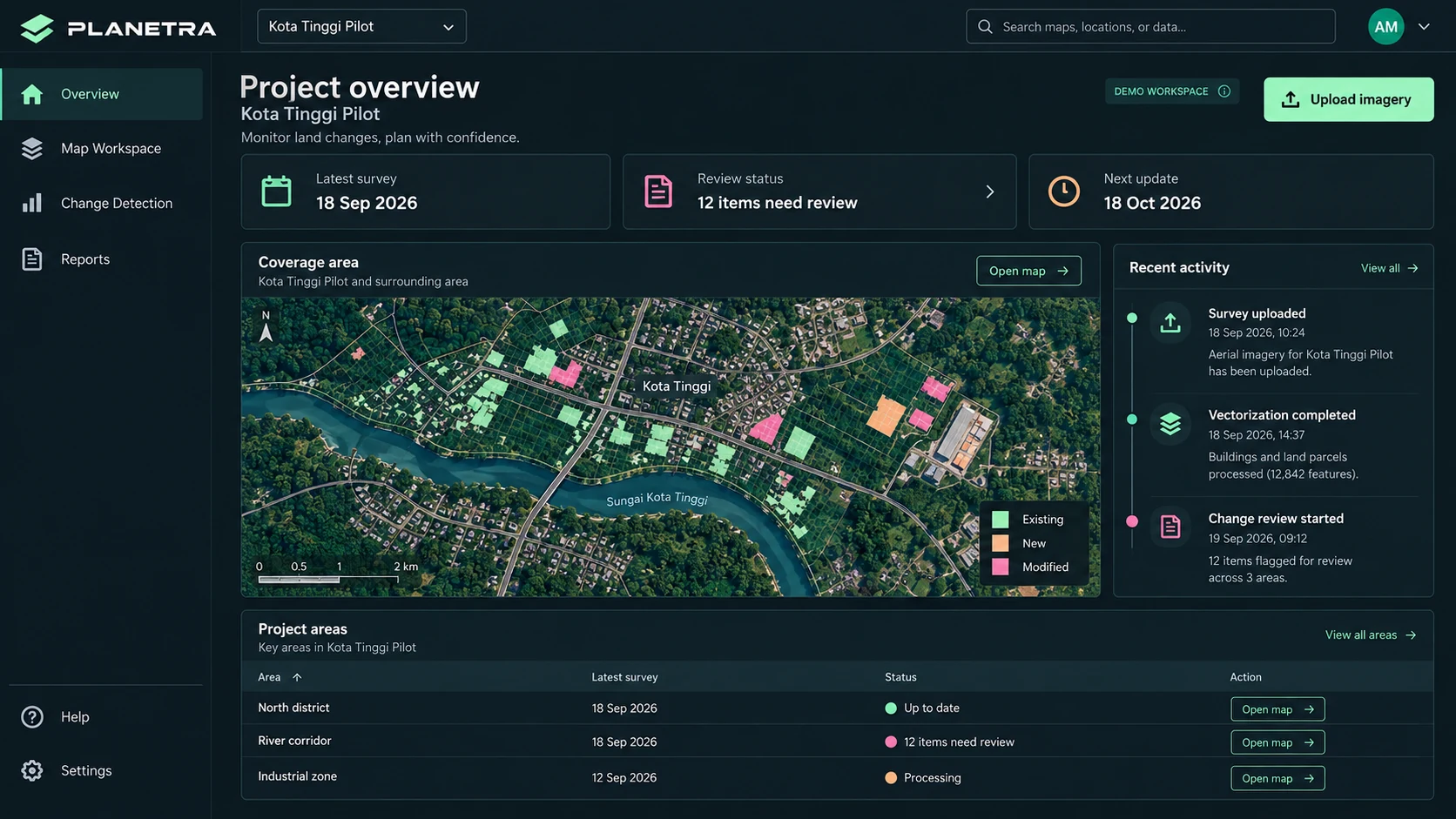
The PLANETRA platform follows the same workflow our team uses today: upload a survey, review the map, check what changed, then prepare the report.

Concept screens of a platform in development. Today our team delivers maps, insights and reports to you as a service. Data shown is illustrative.

Concept of the PLANETRA platform: Project overview screen with latest survey date, items that need review, the next agreed update, a coverage map and recent activity
Concept of the PLANETRA platform: Map workspace screen with a layers panel, aerial imagery with building footprints and a selected building with its details
Concept of the PLANETRA platform: Change detection screen comparing a baseline and an updated survey with a swipe divider and a list of changes to review
Concept of the PLANETRA platform: Reports and delivery screen with a report builder, a report preview, recent reports and the delivery schedule

Start a conversation

Tell us about the area you manage.

We will discuss coverage, the outputs you need and an update interval that fits your work. Request a demo or talk through a project.

Malaysian-rooted, globally ambitious.Local knowledge helps us interpret context and work closely with clients, and our outputs are built to be read anywhere.